
New Flash Floods and Landslides on Tristan
Initial report from Philip Kendall and Kelly Green, with additional photos from Nick Schönfeld
On the 2nd February 2024, it had been raining heavily overnight, but nothing suggested what was to come. The Tristan da Cunha community woke up before daylight to the sounds of thunder. However, it was not thunder, but flash floods pouring down from the mountain.
At 07:00am, Administrator Philip Kendall's phone started to ring, with stories coming in of water, mud and rocks coming down the Big Watron in the East of the settlement and in Hottentot Gulch to the West. He went straight up to the south east corner of the settl ement to find houses flooded with muddy water. The Watron was full of rubble, and the water had breached its banks.
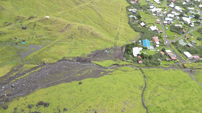
Drone view of the debris field at the Big Watron. Photo: Nick Schönfeld.
Many island homes and the creche have been affected by the flooding, some much worse than others, meaning people have had to move out. Approximately ten houses are not currently habitable.
Kelly Green says that in the 12 years she has been on the island this is the worst flooding she has seen. Even her own kitchen was flooded, although others were much more severely affected.
 |
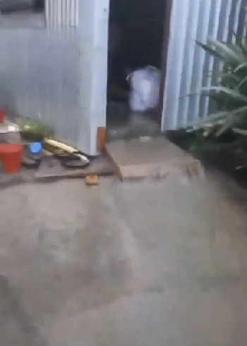 |
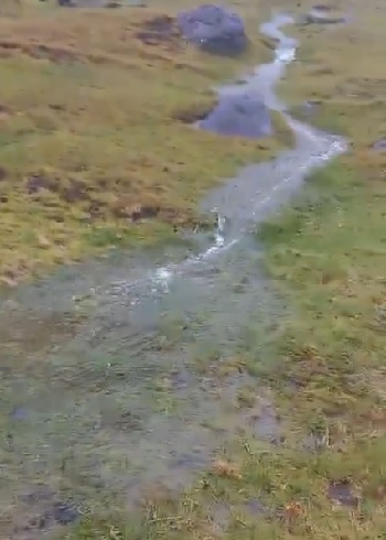
| Surface water gushing over pasture by the Big Watron | Floodwater flowing out of a building in the settlement |
| Stills from videos by Kelly Green | |
Satisfied that there were no injuries, Philip went into his office and called around to see what was needed. He also informed the Governor in St Helena and FCDO headquarters in the UK.
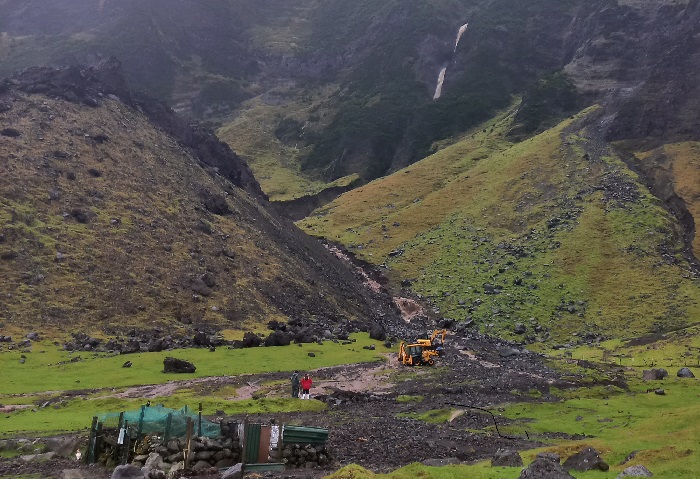
As the day progressed it became clear that the damage to the west side of the settlement was just as bad. The road to the Patches was, and remains blocked. Nick Schönfeld flew his drone over the affected areas and the damage was clear. The road has been washed away near where the 2019 landslide occurred.
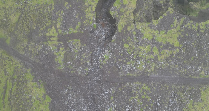
Nick Schönfeld's drone photo shows the blocked road to the Patches. The line of an earlier road that was cut by previous washouts can be discerned above the current road.
It was a very busy day for the community, as everyone is now trying to work together to deal with the aftermath. Philip is in awe of the families and friends of those affected who have flocked to help those in distress. The resilience of islanders in the face of adversity impresses him continuously.
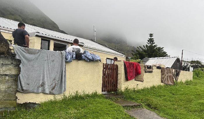
Flood damaged carpets, mats and fabrics hung out to dry outside one of the affected island homes. Photo: Philip Kendall
Thankfully the rain has stopped, and it is hoped the weekend will be drier. The PWD workforce will be working to clear the Watron and the Gulch, and they will also be trying to clear the way out to the Potato Patches to check for damage out there. By Monday we should have a clearer idea of the amount of work ahead.
PWD working with diggers to divert the water cascading down the mountain from behind the 1961 volcano away from the Big Watron and island homes. Photo: Kelly Green
Some Background
Tristan has a long history of rock falls, wash outs, and landslides. Friday’s situation is exactly the type of eventuality that scientists Anna Hicks and Neil Golding were looking at during their survey work on the island in 2022. Among other things, they found a large fissure on the cliff tops that presented a future hazard. No doubt they will be anxious to get back to Tristan to re-examine the landscape has changed since they did their baseline survey.